
15 of the Best Lake District Walks, From Easy Strolls to Challenging Hikes

The Lake District National Park in northwest England is a paradise for hikers. Mighty peaks such as Blencathra and Helvellyn beckon walkers for a challenging day out in the hills, while glistening lakes and valleys freckled with sheep create a striking backdrop.
It’s truly one of the most beautiful places in the country, and was a source of inspiration for literary greats such as Beatrix Potter, Alfred Wainwright, Arthur Ransome, and William Wordsworth. There are hundreds of miles of walking trails in the region; some ramble gently alongside lakes while others wend along mountain passes and over craggy peaks.
This guide will showcase 15 of the best walks in the Lake District. There’s something for every ability level, from easy strolls around Buttermere and Rydal to challenging hikes up Helvellyn and Haystacks.
Easy
1) Buttermere Lake
2) Tarn Hows
3) Grasmere to Ambleside
4) Keswick to Friar’s Crag
5) Rydal Water & Cave
Easy Lake District Walks
These easy Lake District walks are short (roughly 2 hours or less) and relatively flat, making them ideal for families or people looking for a relaxing stroll.
Buttermere Lake Circular
Distance: 4.5 miles | Time: 2 hours | Start/Finish: Buttermere Village | Map: Click here
The Buttermere valley boasts some of the best scenery in the area and is regularly voted as one of the country’s favourite views. It’s no surprise then, that this loop around Buttermere Lake is one of the best Lake District walks.
Starting in the beautiful village of Buttermere, this 2-hour circular walk loops around the entirety of the lake. Along the way, you’ll pass ravines, woodland and spectacular views of Haystacks — Wainwright’s favourite mountain.
Buttermere is one of the smallest lakes in the Lake District and is suitable for almost everyone. A stroll around its shores is one of the easiest ways to enjoy the gorgeous views of the Lakeland fells.
Full guide here: Buttermere Lake Circular
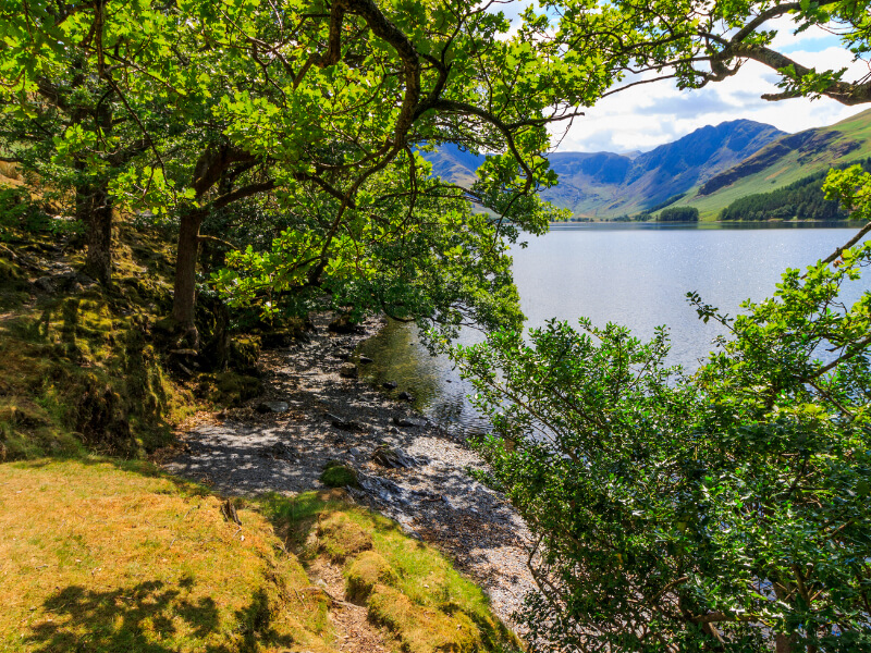
Tarn Hows & Rose Castle Plantation Circular
Distance: 2 miles | Time: 1 hour | Start/Finish: Tarn Hows car park | Map: Click here
This easy stroll around Tarn Hows will treat you to views of grassy moors, the trees at Rose Castle Plantation and the tarn itself, while Coniston and Langdale Pikes create a scenic backdrop. There are gorgeous views all the way, and numerous benches and grassy banks provide plenty of space to sit and admire the scenery.
This Tarn Hows walk is ideal for families, as the trail is surfaced, easy to follow and there are basic food supplies and toilets available at the car park. As you can imagine, this walk can get very busy in peak season so it’s best to arrive early.
During your walk, you’ll hopefully catch a glimpse of rare Belted Galloway cattle or Herdwick sheep grazing by the tarn. And if time allows, I recommend taking the detour from the main path to visit the pretty Tom Ghyll Waterfalls.

Did you know? ‘Tarns’ are small mountainside lakes that can be found throughout the Lake District.
Grasmere to Ambleside (The Coffin Route)
Distance: 3.8 miles | Time: 2 hours | Start: Grasmere | Finish: Ambleside | Map: Click here
The Coffin Route is an easy Lake District walk between the two towns of Grasmere and Ambleside. If you’re wondering why it’s called The Coffin Route, it’s because the trail was used in medieval times to carry the dead to St Oswald’s Church in Grasmere for burial. The route is a little more cheery these days, with beautiful views across the water bodies of Grasmere and Rydal.
It’s a gentle, lowland trail with two lovely villages at either end, making it perfect for foodies who enjoy country pubs or tearooms at the end of a walk. If ending in Grasmere, I recommend coffee and cake at Lucia’s Coffee + Bakehouse; if ending in Ambleside, head to The Unicorn for a traditional feel and a hearty pub meal.
The scenery in these parts was a strong muse for Wordsworth and along the way, the route passes two of his homes, Rydal Mount and Dove Cottage. They are both open to the public and can easily be visited on the walk.

Keswick to Friar’s Crag
Distance: 1.7 miles | Time: 50 minutes | Start: Keswick | Finish: Friar’s Crag | Map: Click here
This short but sweet Lake District walk will take you on an easy stroll along the shores of Derwentwater. From the shoreline, you’ll be able to see Derwent Isle, a small island in the middle of the lake, as well as the peaks of Maiden Moor and Catbells in the background.
You’ll then walk up a packed gravel path to the end of Friar’s Crag, where you’ll spot the iconic bench and viewpoint over the lake. The view from Friar’s Crag is one of my favourites in the world; it’s dramatic in the winter and peaceful in the summer.
For anyone with small children or only an hour or so to spare, I recommend this beautiful walk without hesitation.

Rydal Cave & Water
Distance: 2.8 miles | Time: 1 hour | Start/Finish: Rydal Water car park | Map: Click here
This short but varied walk rambles through open countryside with excellent views of Rydal Water and the rugged Loughrigg Fell in the distance. It will take about an hour to walk, but you’ll likely want to spend longer on the trail as there’s plenty to see.
One of the highlights of this walk is Rydal Cave, which is actually an old quarry. It was supposedly used to mine slate tiles for the local buildings around 200 years ago but now lies dormant. It’s worth taking the time to go inside and have a look around the cave.
The return path will skirt you along the banks of Rydal Water itself. There are a few little beaches where you can go to the shoreline to relax by the water or even take a dip if the weather is warm enough.
Full guide here: Rydal Cave & Water walk

Moderate Lake District Walks
These moderate Lake District walks are more physically demanding than the easy ones as they involve fell walking. However, they are walks on the smaller fells and are doable for people with average fitness.
Catbells
Distance: 3.6 miles | Time: 2.5 hours | Start/Finish: Hawse End | Map: Click here
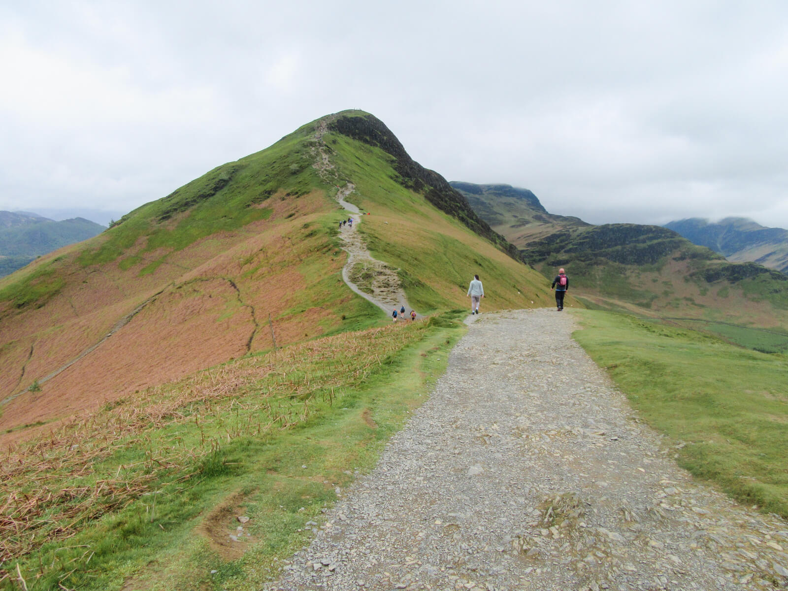
Because of its close proximity to the busy town of Keswick, Catbells is one of the most popular walks in the Lake District. Not only this, but it’s one of the easier fells in the region and so is a great choice for beginners looking to tackle their first fell. Catbells was actually the very first peak I conquered at the keen age of 6.
The trail to the summit is steep but short, and you may need to scramble slightly in a couple of places, but nothing is too difficult. With great views over Derwentwater, you are rewarded with stunning scenery all the way.
Full guide here: Catbells walk
Loughrigg Fell Circular
Distance: 7.6 miles | Time: 4.5 hours | Start/Finish: Ambleside | Map: Click here
This circular Loughrigg Fell walk is easily accessible from Ambleside and will take you on a tour of scenic woodland, craggy peaks, sheep-peppered valleys and glistening lake views.
It’s an ideal walk if you’re looking for great scenery without too much effort or scrambling, which are often required when tackling many of the larger peaks. In fact, Alfred Wainwright once said “no ascent is more repaying for the small labour involved”, and I have to agree.
The summit of Loughrigg Fell showcases magnificent views of the surrounding water bodies, including Loughrigg Tarn, Grasmere, and Rydal Water, as well as sweeping views of the area’s valleys.

Grisedale Pike Circular
Distance: 6.8 miles | Time: 4.5 hours | Start/Finish: Whinlatter Pass | Map: Click here
This beautiful walk to the summit of Grisedale Pike takes you up into the Lake District’s northern fells. It feels as though the view from the top goes on for miles, and on a clear day, you’ll be able to see all the way across to Scotland and the Isle of Man.
The route starts off quite steep, but you’ll have views of Derwentwater behind and mountain views ahead. There’s a short scramble with some loose scree near the peak, but nothing is too difficult. The descent will take you down into a pretty valley and the last hour of the walk is a relaxing stroll along Coldale Beck.

Glenridding Dodd, Heron Pike and Sheffield Pike Circular
Distance: 5.8 miles | Time: 3 hours | Start/Finish: Glencoyne | Map: Click here
This circular hike features a series of sensational viewpoints over Ullswater, the Lake District’s second-largest lake. It begins by skirting along Mossdale Bay, before heading up Stybarrow Pass and round to the peak of Glenridding Dodd. This peak is relatively small at 442 metres, but its top is an exceptional viewpoint for Ullswater and for the valleys and fells around Patterdale.
From Glenridding Dodd, the route will continue up to the peaks of Heron Pike (612m) and Sheffield Pike (675m) before the elevation starts to come down. Despite reaching three peaks, this walk is not too challenging overall, and the myriad viewpoints make it unforgettable.

Rannerdale Knotts Circular
Distance: 4.1 miles | Time: 2.5 hours | Start/Finish: Buttermere | Map: Click here
Rising from the Buttermere valley, Rannerdale Knotts (355m) is one of the smaller Lake District fells. It’s not all about height though, as the excellent positioning of Rannerdale Knotts means it boasts sensational views of the surrounding valleys.
Beginning in Buttermere, the trail heads up a steep path. It may seem challenging at first, but after a mere 30 minutes, you’ll have reached the top of the ridge. The rest of the walk is a gorgeous ridgetop stroll with views of Crummock Water ahead and Buttermere behind.
The descent from Rannerdale Knotts’ summit will take you down a grassy slope before skirting you along the edge of Crummock Water. Why not take a dip before heading back to Buttermere?
Full guide here: Rannerdale Knotts walk
Challenging Lake District Walks
These challenging Lake District walks are physically demanding due to long distances and steep ascents.
Buttermere and Haystacks Circular
Distance: 8 miles | Time: 4.5 – 5 hours | Start/Finish: Buttermere | Map: Click here
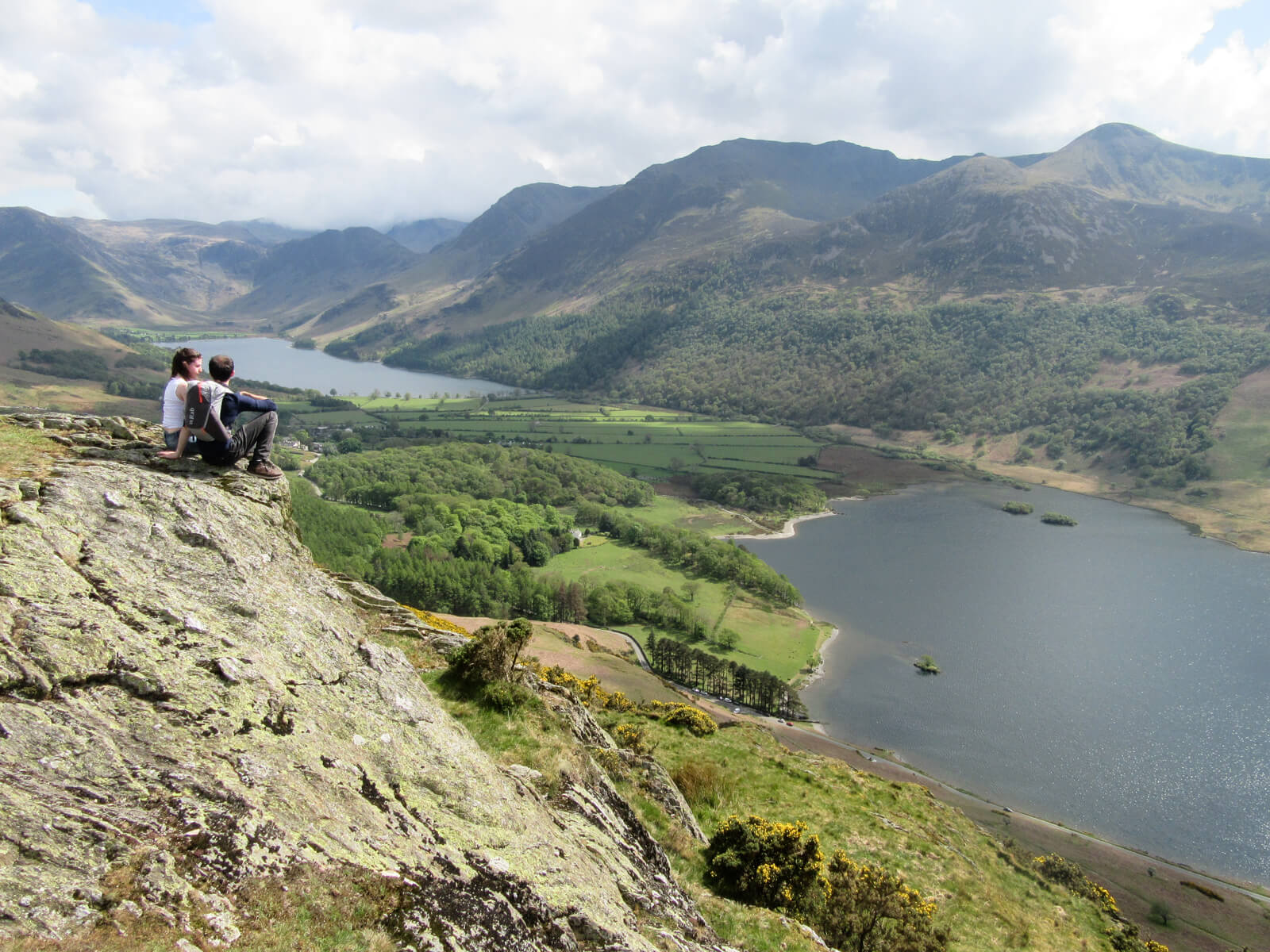
Buttermere boasts some of the best scenery in the region and this walk showcases it particularly well. Combining the path around Buttermere Lake with the trail to the Haystacks summit, this long but gorgeous walk offers lots of variety.
Views of the soaring Buttermere Valley and the distinctive rocky humps that give Haystacks its name are part of what makes this Lake District walk so dramatic. Haystacks was Alfred Wainwright’s favourite fell — in fact, the author’s ashes are scattered in Innominate Tarn at the top of the fell.
This walk can be shortened by skipping Buttermere Lake and instead starting and finishing from Gatesgarth, as shown on this map. This shorter version is ideal for those who just want to summit Haystacks — you’ll still be treated to epic views over Buttermere Lake!
Full guide here: Haystacks & Buttermere circular

Blencathra via Sharp Edge
Distance: 5.3 miles | Time: 4 hours | Start/Finish: Scales Farm | Map: Click here
The walk up Blencathra has made it onto this list because it’s one of the most thrilling ridge walks in the region. This route will require you to scramble over two ridges: Hallsfell and Sharp Edge, the latter of which is the most exposed Grade 1 scramble in the Lake District.
Requiring nerves of steel and a head for heights, scrambling on Sharp Edge should not be undertaken lightly. It has a fearsome reputation, but for experienced fell walkers who have done some scrambling before, Sharp Edge offers an exciting approach to Blencathra.
Like most of the big peaks, I recommend tackling Blencathra on a clear day, as a misty sky will disrupt the stunning views from Hallsfell. You don’t want your adrenaline high to be diminished by a view of clouds.

Helvellyn via Swirrel and Striding Edge
Distance: 7.3 miles | Time: 5 hours | Start/Finish: Glenridding Village | Map: Click here
Helvellyn and Striding Edge need little introduction as they are perhaps the best-known duo in the Lake District. At 950m tall, Helvellyn is the third highest peak in England, and as you would expect from such height, the view from the top is spectacular. And while Helvellyn alone is a superb mountain, the epic approach along Striding Edge makes it one of the best walks in the Lake District.
Make sure you’re well-fed and watered before you set off — Striding Edge is steep, and will involve some scrambling. It’s a Grade 1 scramble and there is little in the way of technical difficulty, but you’ll need a good head for heights.
The climb is worth it though, as you’ll be treated to sensational views across the fells and of the picturesque Red Tarn. Helvellyn via Striding Edge is a truly classic walk and was even voted as the nation’s favourite walk in an ITV special.

Scafell Pike Corridor Route
Distance: 9.1 miles | Time: 6.5 hours | Start/Finish: Seathwaite Farm | Map: Click here
This wouldn’t be a complete guide to the best Lake District walks without Scafell Pike, England’s highest peak. At 978 metres, it’s certainly impressive and beckons to be conquered by visitors to the region.
There are several routes you can take to the summit of Scafell Pike, but I’ve chosen to include the route from Seathwaite (often called the Corridor Route). While the route from Wasdale Head is the most popular — probably because it’s the shortest and easiest way up — the Corridor Route is the most beautiful.
This long walk will showcase mountain streams, craggy peaks and soaring views across to Great Gable. The return trail runs alongside Ruddy & Grains Gill, where a stream has cut a small canyon creating a series of pretty waterfalls.
Full guide here: Scafell Pike Corridor Route
The Old Man of Coniston
Distance: 3.7 miles | Time: 2.5 – 3 hours | Start/Finish: Walna Scar Road | Map: Click here
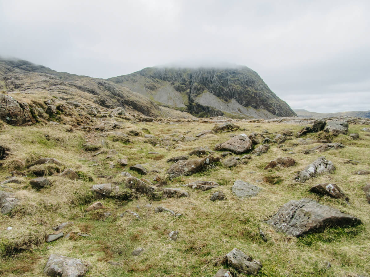
The Old Man of Coniston is a classic Lake District walk, with its unusual name having made it famous among visitors to the region. It’s a unique walk despite the name, mixing rugged mountain scenery with interesting history thanks to the abandoned mine sites scattered across its base and lower slopes.
The route up to its summit (803m) is steep but beautiful, with sweeping vistas of the old copper mine and slate quarry below. From the top, you’ll be able to see Low Water and Goat’s Water tarns, and on a clear day, as far as Morecambe Bay.
If you’re keen for a real challenge, you can take a longer, alternate Old Man route that goes via Goats Water tarn and up to the summit of Brim Fell (796m). It’s a more scenic option but takes about 5 hours to complete. Get the map here.
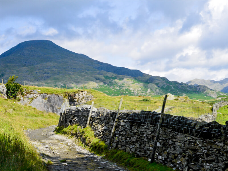
Did you know? The Old Man of Coniston isn’t named after some old guy who used to live in Coniston. Old Man originates from the ancient Celtic Alt Maen, meaning High Stone, and Coniston comes from the Norse Konigs Tun, meaning King’s Farm.
BONUS: The Cumbria Way
Distance: 73 miles | Time: 5-6 days | Start: Ulverston | Finish: Carlisle | Map: Click here
The Cumbria Way is an epic 73-mile ramble that will take you on a journey through some of the best scenery the Lake District has to offer. Starting from Ulverston in the south and snaking its way up to Carlisle in the north, the trail hits highlights such as Coniston Water, Tarn Hows, Dungeon Ghyll, Derwentwater and Keswick along its way.
The Cumbria Way is a trip in itself, rather than a day out, but it truly deserves its place as one of the best long-distance walks in the Lake District.

More Lake District inspiration

PLANNING
Where To Stay In The Lake District
Compare Keswick, Ambleside, Grasmere, Borrowdale, and more.
PLANNING
Weather, wildlife, crowds, and seasonal quirks throughout the year.

PLANNING
Four-Day Lake District Itinerary
Try my four-day hiking itinerary, based in Keswick and the northern Lakes.
PLANNING
How To Get Started With Wainwright Bagging
What is Wainwright Bagging, and how do you start?

PLANNING
How To Visit The Lake District Without A Car
Advice on where to stay, public transport, and more.
- Can’t decide where to stay? Here’s my guide on choosing where to base yourself in the Lakes.
- Discover the best time of year to visit the Lakes.
- Try my four-day Lake District itinerary, based in Keswick and the northern Lakes.
- How to get started with Wainwright Bagging.
- How to visit the Lake District without a car.
⛰️ Want even more? Visit my Lake District Hub to browse all my walking guides and planning tips.

About The Author
Lauren Pears is a freelance travel writer and blogger who writes about active adventure travel. She’s been blogging for almost 10 years, and has written for publications such as Lonely Planet, World Nomads, and Southeast Asia Backpacker.
Thank you for reading! If you found this post useful, I’d be grateful if you would consider using the affiliate links below when planning your travels. I’ll make a small commission at no extra cost to you. This will help me to keep this blog running. Thanks for your support — Lauren.
Accommodation – Booking.com
Flights – Booking.com
Travel insurance – World Nomads
Excursions & tours – Viator
Outdoor gear – Decathlon
eSIMs – Airalo
Alternatively, you could buy me a coffee to say thanks!


