Lyndhurst Parish Walk: Directions & Guide

Explore the forest, heathland, lanes and hamlets surrounding the pretty New Forest village of Lyndhurst on the Lyndhurst Parish Walk.
The Lyndhurst Parish Walk is a 9-mile route that roughly follows the district boundaries of this popular New Forest village. It’s a circular walk, beginning and ending at Bolton’s Bench, a well-known landmark just outside of Lyndhurst’s town centre.
The route typically takes 3-4 hours to complete, although it’ll take longer if you happen to get lured in by one of the charming pubs en route (I sure did!). The scenery is also quite varied, taking you along forested tracks, across heathland, along country lanes and through small villages.
Sound good? Let’s go!
Lyndhurst Parish Walk Logistics
Start/Finish: Bolton’s Bench, Lyndhurst
How to get there: There is a car park in Lyndhurst centre, or you can take the number 6 bus to Lyndhurst Fire Station.
Distance: 9.1 miles
Time: 3-4 hours
Difficulty: Moderate; the route is not so easy to navigate. You’ll need to refer to a map often. Walking paths are mostly flat.
Map: Get it here
Lyndhurst Parish Walk: Directions And Route Details
Keep in mind that this walk follows the boundaries of Lyndhurst Parish. This means it will occasionally take you off designated walking paths and onto roads. The route will not always do what seems most obvious!
This is so that the trail can keep to the parish boundary and go through some of the quaint hamlets surrounding Lyndhurst. I enjoyed this aspect of the walk, though, as it kept it interesting and meant I passed by lots of pretty houses and cosy pubs.
Begin at Bolton’s Bench
The Lyndhurst Parish Walk officially begins at Bolton’s Bench, which is quite a well-known landmark in the New Forest. It’s essentially a few benches circled around a huge yew tree on a hilltop. You can get to it from Lyndhurst town centre by walking east along the high street, past Anissa’s Thai Kitchen and the bus stop.
Just past the bus stop, you’ll see a cattle grid-blocked road going to the right. You should see the big yew tree from here.

From Bolton’s Bench, you’ll want to walk east along the road towards Bolton’s Bench Car Park East. Pretty much as soon as you’ve walked through the car park, you’ll enter open heathland. Follow the ridge straight ahead for about 300m, and then take the path that veers to the right.
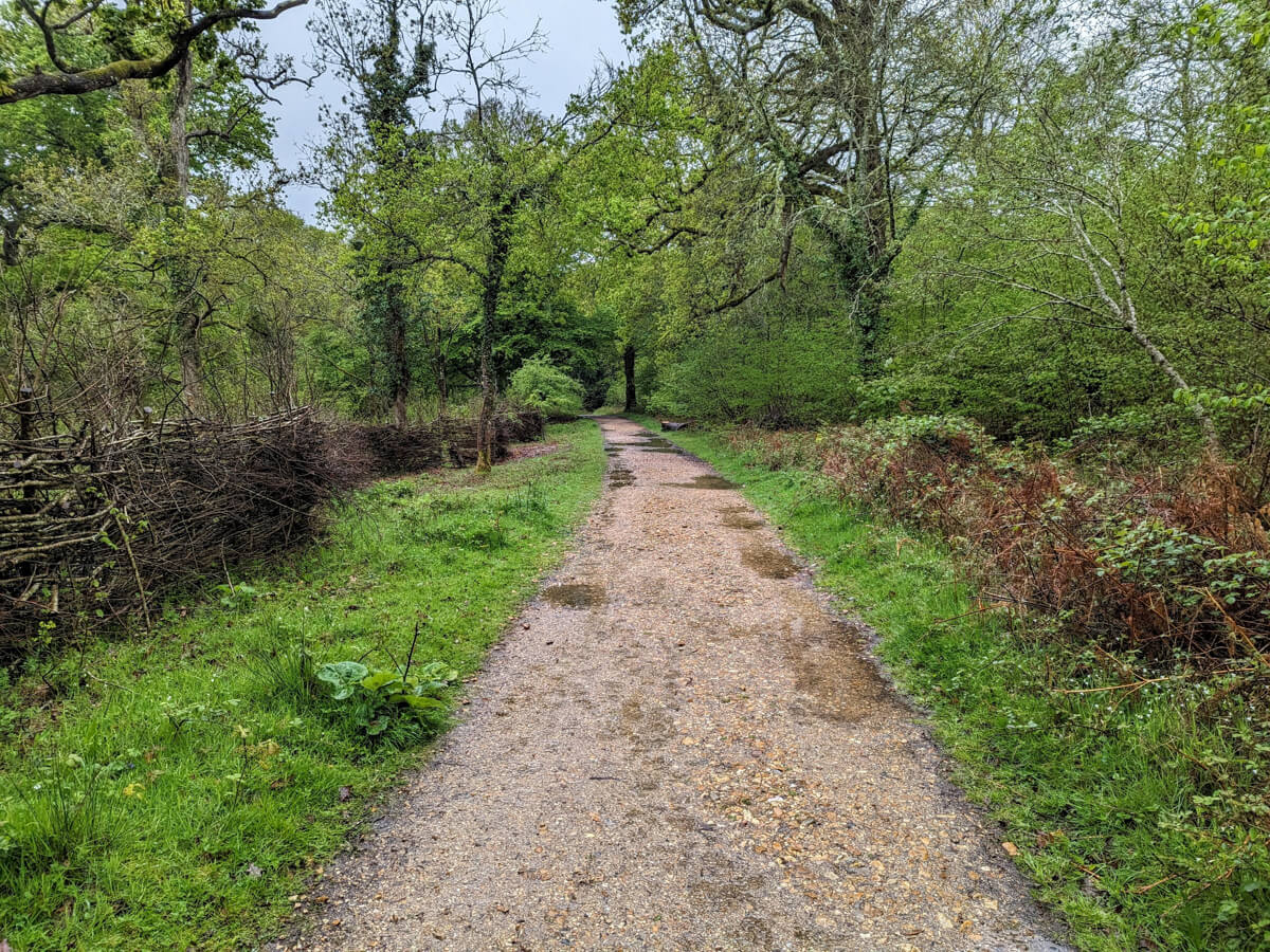
As you can see from my photos, it was a rather rainy day. The trails can get quite boggy in wet weather, so be prepared with appropriate footwear.

Into Pondhead Inclosure
The route will take you across the B3056. You’ll enter a little path with some pretty houses at the end, and to the right of these houses is the entrance to Pondhill Inclosure.

Once inside Pondhill Inclosure, you’ll be able to walk along easy-to-follow tracks. I also spotted a few bluebells here.
Through Foxlease
After some time, you’ll come to a busy road (the A337). You should see a “Welcome to Lyndhurst” sign to your right. There’s a small gate to the left of the sign — go through it, and follow the path round to the left.

After walking down the gravel track a short way, you should see a cattle grid ahead of you. You don’t want to go over this as it will take you to Coxlease School. Instead, take the path that goes left just before the cattle grid, keeping the fence to your right.
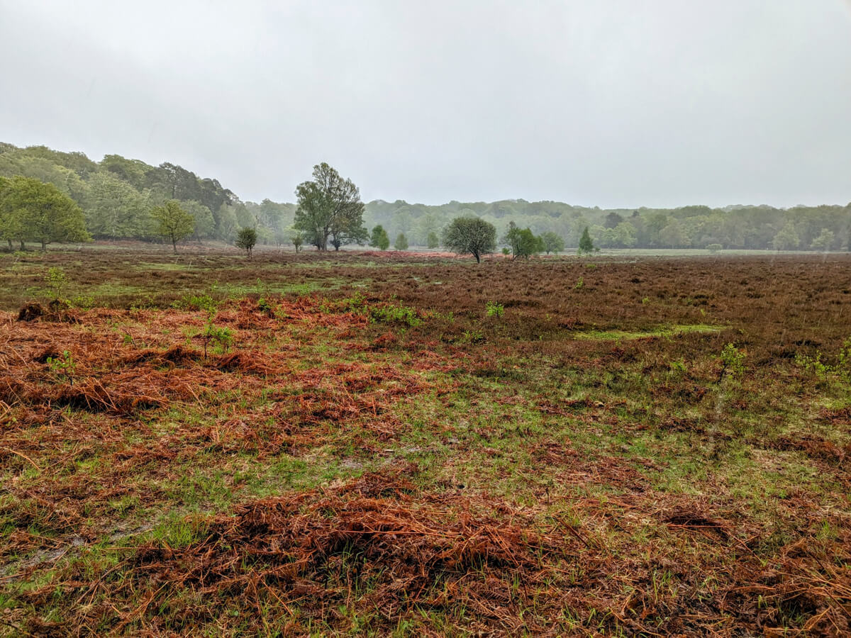
Navigate across the heathland and into Brick Kiln Inclosure
I really recommend you keep a close eye on your map at this point as things can get complicated.
You’ll soon arrive at open heathland. Instinct told me to walk straight along the path ahead of me, but this was wrong and I had to backtrack. You’ll actually need to ensure you keep the aforementioned fence on your right, meaning you’ll have to bear right along with it at the fork.
After about 200m, you should see a gate on your right, at which point, you’ll need to take the trail that goes left across the heathland and to the forest on the opposite side of the clearing. You should see another gate at this point — go through it into Brick Kiln Inclosure. Once in Brick Kiln Inclosure, you’ll very quickly need to take a right turn.
Along Pinkney Lane
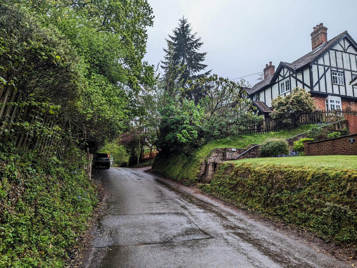
The trail will lead you to another gate which opens onto a quiet road called Pinkney Lane. Exit left through the gate, and follow the road round. A little way along, you’ll spot an old cottage called Thatch House — it’s very quaint and makes for a great photo.
At the end of Pinkney Lane, you’ll have arrived at Bank, where there is a very sweet pub called The Oak Inn. I recommend stopping here for a coffee, or in the summer months, perhaps a refreshing lemonade in their beer garden.

On to Gritnam and the underpass
Take a left from the Oak Inn (as if you are facing away from the pub), and follow the lane down to the little hamlet of Gritnam. You’ll circle the cluster of houses at Gritnam, and just before you come back to the path you were originally on, you’ll veer off left into the forest along a grassy path.

After a short while of walking among the trees, you’ll come to a gate which leads onto a busy road. Don’t go through the gate, but instead, turn left and follow the (unobvious) path parallel to the main road. You’ll soon come to an underpass. Go through it, and take the path that goes off to the right (up a tiny hill) on the other side.

Through Allum Green
From the underpass, you’ll have made a right turn and followed a path that leads onto a clearing called Allum Green. You should see some houses in the distance as you approach it. I thought these houses were quite charismatic and couldn’t resist taking a photograph of the stripey one.
It was also on Allum Green where I saw my first New Forest ponies of the walk. Seeing them so late into the day was unusual. I typically see ponies almost everywhere in the New Forest, but perhaps the bad weather had caused them to seek shelter.
There’s a track to the left of the houses on the green, which will take you back into the forest with a long, brick wall on your right-hand side.


Along Cut Walk
The track that you’re now walking on is called Cut Walk. If you’re doing the Lyndhurst Parish Walk on or after a rainy day, be prepared for serious mud. In fact, Cut Walk may as well be renamed to Mud Walk.
Cut Walk is quite a long, straight track, so you’ll just need to keep walking ahead. There is a slight hill at the end of the track — once you reach the top, turn left, follow the path round and make another left. The path will now wind downhill to the New Forest Inn at Emery Down.

Emery Down
As you come out of the trees, you should see the New Forest Inn on the left. This is a traditional 18th-century pub, and makes a great lunch stop. They have lots of delicious pub grub options, including grills, burgers, pies, sandwiches and lots of vegetarian/vegan options, too. There’s also a pretty beer garden to enjoy in warm weather.

Silver Street & Pikes Hill
As you’re facing away from the New Forest Inn, turn right and walk down Swan Grn a little way, past the church, and turn left onto Silver Street. There’s a gate at the end of Silver Street which you’ll need to go through to follow the trail through the trees.
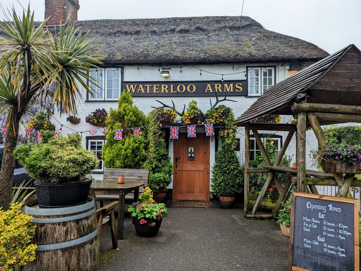
Upon reaching the road, make a right turn onto Pikes Hill. You’ll need to walk along the tarmac road for a little bit now, but fortunately, the road is quiet. Keep following Pikes Hill past Fenwick Hospital, across the cattle grid, and past the Waterloo Arms, until you reach the A337.
Past the New Forest Golf Club
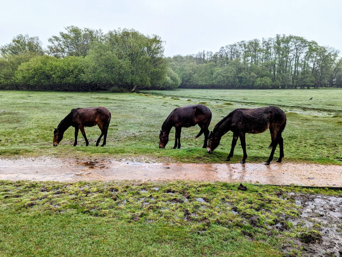
Once you reach the A337, cross over, turn right and then make a pretty immediate left down Racecourse View. You should soon spot a gate on your left that opens onto a field. Go through it, and follow the lightly defined path across the grass (where the ponies in the photo below are standing).

The light path will soon become a paved path, making it easy to follow. You’ll turn right once you hit trees and will walk parallel to the New Forest Golf Club. The paved path will become a grassy path again — just keep the golf club on your left as you walk along it.
Through Heathland back to Bolton’s Bench
As you come out of the Golf Club, you’ll hit the A35. You’ll just need to cross the road and climb over the style on the fence in front of you.

You’ll be in a large, open expanse of heathland. You’ve been here before, as this is the heathland that leads to Bolton’s Bench. The paths aren’t well defined though, so you may need to use your map to help you navigate back to Bolton’s Bench, where the Lyndhurst Parish Walk ends.


About The Author
Lauren Pears is a freelance travel writer and blogger who writes about active adventure travel. She’s been blogging for almost 10 years, and has written for publications such as Lonely Planet, World Nomads, and Southeast Asia Backpacker.
Thank you for reading! If you found this post useful, I’d be grateful if you would consider using the affiliate links below when planning your travels. I’ll make a small commission at no extra cost to you. This will help me to keep this blog running. Thanks for your support — Lauren.
Accommodation – Booking.com
Flights – Booking.com
Travel insurance – World Nomads
Excursions & tours – Viator
Outdoor gear – Decathlon
eSIMs – Airalo
Alternatively, you could buy me a coffee to say thanks!


