
The Surf Coast Walk: Explore Victoria’s Picturesque Coastline On Foot

This is a guest post by Audrey of Victoria Uncovered.
The Surf Coast Walk is an incredible walking track that lets you explore the stunning natural beauty of Australia’s Victoria coastline on foot. The trail begins at Torquay, the official start of the iconic Great Ocean Road, and meanders along cliffs and beaches all the way to Fairhaven.
The Surf Coast Walk is 44 kilometres long and is generally considered to be a moderately challenging route. You can complete the entire trail, or you can cherry-pick from its 12 sections. Each section has a clear start and end point, usually located at a car park. For those who do want to walk the entire trail, we recommend taking 2 days, as it takes an average of 10.5 hours to complete it.
Along the way, you’ll walk by rugged cliffs and secluded beaches, and will pass through some of the region’s most picturesque towns, such as Anglesea and Aireys Inlet. These make great pitstops for popping into a cute coastal café to recharge with a coffee and some snacks. Staying overnight in one of the local caravan parks or motels allows you to take your time and soak up all that this region has to offer.
In this guide, we provide all the information you need to make the most of this amazing walk along the Surf Coast. We’ll cover the route in detail, highlight places of interest and activities along the way, and offer advice on how to prepare for your journey.
Surf Coast Walk: Map & Logistics
Where is the Surf Coast?
The Surf Coast is located in southwestern Victoria, Australia, just over an hour’s drive from Melbourne. It’s the official start of the world-famous Great Ocean Road and passes through the towns of Torquay, Anglesea, Aireys Inlet, and Lorne amongst others.
How long is the Surf Coast Walk?
The Surf Coast Walk spans 44 kilometres from start to finish, but you don’t have to tackle it all at once. The trail is divided into 12 sections, each with a designated start and end point, conveniently located near car parks for easy access.
Where does the Surf Coast Walk start?
The eastern starting point of the Surf Coast Walk is Point Impossible, a lovely beach located 5 kilometres east of Torquay. On the other western end, you’ll find Fairhaven Surf Lifesaving Club, situated just past Aireys Inlet. Whether you prefer to start from the east or the west, the choice is yours.
What should I bring on the Surf Coast Walk?
Coastal weather can be unpredictable so wearing layers is a good idea. While proper hiking boots aren’t essential, make sure to wear supportive and comfortable footwear. Don’t forget sun and rain protection, snacks, and plenty of water.
Are dogs allowed on the Surf Coast Walk?
You’re welcome to bring your doggy friend along on most parts of the walk — just remember to keep them on a leash. Although you’ll find some dog waste bag dispersers along the trail, it’s a good idea to have your own bags handy too.
The walk itself
Day 1: Point Impossible To Anglesea
The Surf Coast Walk begins at Point Impossible which merges into Fisherman’s Beach. Here, you’ll find a cosy café and plenty of boats entering or departing from the boat ramp and sailing club.
Once you’ve had your fill of the beach, you’re just a stone’s throw away from the attractions in Torquay’s town. Here you can indulge in delicious food, see Australia’s first surf museum, or pick up a bargain at one of the many discount surf shops.
Alternatively, take a break on the expansive grass area at the Torquay Foreshore which sits on Torquay Front Beach. This beautiful beach is known for its calm and safe waters thanks to Point Danger which protects it from the powerful swells of the Southern Ocean. Located between Point Danger and Rocky Point, Torquay Surf Beach has awesome waves that come in from the southwest side just out past the headland.
If you’re up for some surfing you can rent a board from the Torquay Surf Academy, which is on the other side of the caravan park behind the beach.
You’ll then need to cross a small creek to get to the far end of the beach. If it’s too deep to simply step across there’s a handy boardwalk nearby you can use to cross it. Once you’ve made it across, you can then head on up to Rocky Point Lookout. From this vantage point, you’ll have unrivalled views of Torquay Surf Beach to the east and Jan Juc Surf Beach to the west.
After enjoying the scenery continue along the trail following the stairs down onto the beach. Once you’ve gone past Rocky Point and made your way from Torquay to Jan Juc, you’ll find yourself at the beginning of the world-famous Great Ocean Road.
At the far end of Jan Juc Surf Beach, near Rocky Point, there’s a fantastic wooden deck and viewing area nestled in the dunes behind the beach. If there’s a swell, make your way to the platform and enjoy some time watching the local surfers in action.
Continuing on from Jan Juc, you’ll encounter a stunning stretch of cliffs that lead all the way to Bells Beach. Simply follow the trail that runs between the cliffs and the road. Along the way, you’ll come across Bird Rock Lookout which sits next to the tiny Jan Juc village.

Keep going for about another 3 kilometres until you reach the world-renowned Bells Beach. Be sure to set aside extra time to appreciate Bells Beach and neighbouring Southside Beach. Here you’ll witness world-class surfers conquering massive waves. In fact, Bells Beach plays host to the Rip Curl Pro World Surfing Championship every year over the Easter long weekend.
The Surf Coast Walk takes a slight detour inland as it travels from Bells Beach to Point Addis. You have the option to choose between the most direct route or the Iron Basin Trail, which adds a few hundred extra metres. If you’d like to save some time just take the direct route.
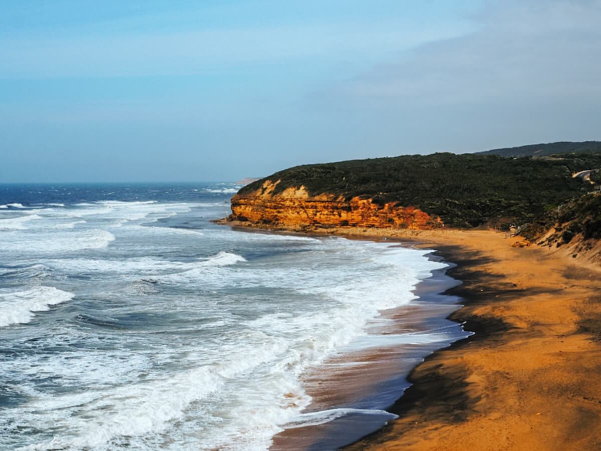
Whichever path you choose, you’ll be surrounded by a dry eucalyptus forest filled with a diverse range of Australian plants, including bracken ferns, grass plants, and grass trees. Keep an eye out for wallabies and koalas and enjoy occasional views of the ocean before returning to the coastline and reaching the cliffs above Point Addis.
Right on the edge of the Point Addis headland, you’ll find a spacious timber boardwalk. Take a seat, enjoy a rest, and cross your fingers hoping to catch a glimpse of some dolphins or whales.
On the west side of the boardwalk, venture down to the beach and continue along the trail for another 7 kilometres until you reach the popular town of Anglesea. You’ll walk along several beaches before the path once again ascends to the top of the dunes and cliffs that are set back about 50 metres from the coast.

After a while, you’ll be able to see the red cliffs that you’re about to cross as you finally arrive in Anglesea. Anglesea is a gorgeous coastal town where you’ll be able to fill up on food and drinks or even rent a paddle boat.
It’s the ideal place to stop for the night with lots of great accommodation to choose from. My top choice for accommodation in Anglesea is the Great Ocean Road Resort. Offering an indoor swimming pool and luxury spa treatment it’s the ideal place to relax after a hard day of walking. It’s also located right on the Great Ocean Road so won’t have to walk far to get there.
Day 2: Anglesea To Fairhaven Beach
The Surf Coast Walk continues across the front of Anglesea, along the river and onto the beach, past iconic spots like Soapy Rocks, Point Roadknight, and Point Addis.
On the other side of Point Addis is Guvvos Beach. This expansive beach goes on for kilometres leading to another surf beach (it’s called the Surf Coast Walk for a reason) at Urquhart Bluff. While you can surf and swim along most of the beach, be aware that there can be strong rips, making it potentially unsafe for inexperienced surfers and swimmers.
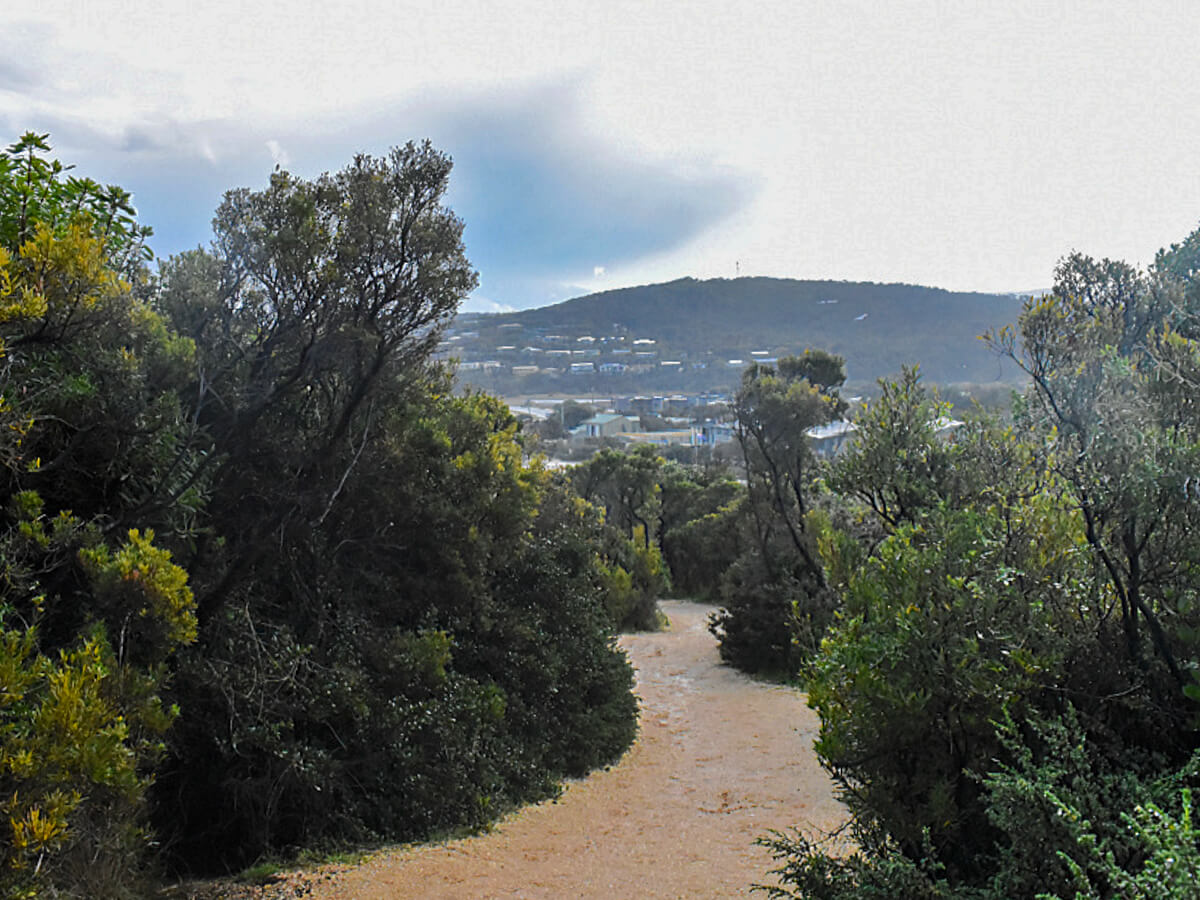
From Urquhart Bluff beach to the township of Aireys Inlet the trail winds over headlands and passes by several beaches surrounded by majestic cliffs. After Urquhart Bluff, make your way to Sunnymeade Beach and check out the interesting stone formation at the eastern end of the beach.
From here, walk to Sandy Gully Beach where you can visit several other beaches like Step Beach located below Split Point Lighthouse. If conditions permit, you can even venture to the base of Castle Rock.
The Split Point Lighthouse is not only a famous landmark and the iconic setting of the 90s children’s show Round The Twist, but it also serves as a milestone on the Surf Coast Walk — you’re nearly at the end!
From the lighthouse, there are fab views of Castle Rock and if you turn to the west, you’ll catch a glimpse of Fairhaven Beach.

Continue down the hill and pass the town stopping in for something to eat if you’re feeling peckish, and then make your way around Painkalac Creek. If the tide is low, you can also cross the creek mouth and stroll along the beach.
Once you reach Fairhaven Beach, where more surfers await, congratulations! You have successfully completed the Surf Coast Walk!

About The Author
Lauren Pears is a freelance travel writer and blogger who writes about active adventure travel. She’s been blogging for almost 10 years, and has written for publications such as Lonely Planet, World Nomads, and Southeast Asia Backpacker.
Thank you for reading! If you found this post useful, I’d be grateful if you would consider using the affiliate links below when planning your travels. I’ll make a small commission at no extra cost to you. This will help me to keep this blog running. Thanks for your support — Lauren.
Accommodation – Booking.com
Flights – Booking.com
Travel insurance – World Nomads
Excursions & tours – Viator
Outdoor gear – Decathlon
eSIMs – Airalo
Alternatively, you could buy me a coffee to say thanks!


